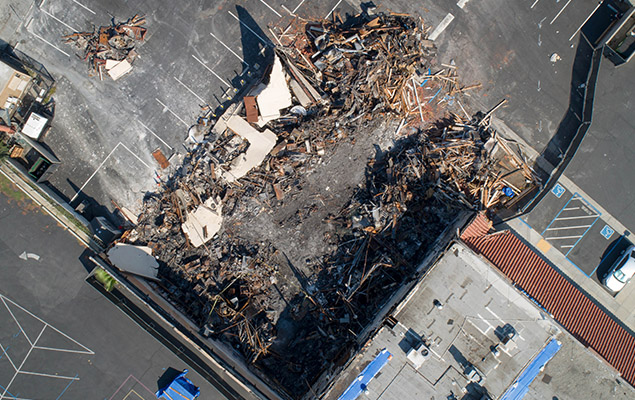
Damage Claims and Repairs
Aerial imagery expedites the claim and damage repair processes by drastically cutting inspection time, and obtaining and documenting vital measurements and characteristics. To allow for a complete representation of buildings and property, aerial imagery integrates a cooperative combination of 2-D (monocular) and 3-D (stereoscopic) information.
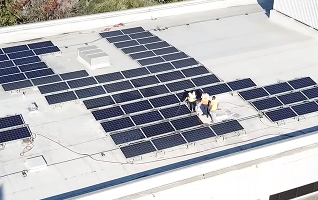
Roof Inspections
Due to its speed and precision, alongside estimation support, nearly 98% of commercial properties use aerial imagery for roof inspections. Aerial imagery provides a faster, safer option for these inspections, with equal or improved accuracy in assessing the condition of a building’s roof.

3-D Site Modelling
An automated building detector drone hypothesizes potential building rooftops. Precise 3-D shape and location of each building is determined by multi-image triangulation under 3-D geometric constraints. A realistic site model can be rendered using virtual “fly-through” graphics. As new images of the site become available, refinement procedures are performed to improve the geometric accuracy of the existing 3-D models. The system gradually updates with new evidence, making the site model precisely complete.
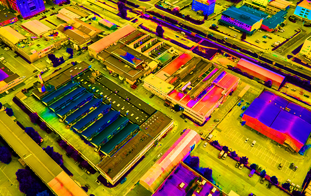
Thermal Imaging
Technological advances have allowed us to accurately capture thermal differences in the exterior envelope of a structure to assist in damage assessment. These thermal differences can be used to diagnose a range of potential issues, such as water damage or insulation deficiencies, allowing for improved ability to pinpoint problems and remediate them efficiently.