View All
By providing photographic and measurement data in a virtual environment to capture every detail of interior space, 3D property scanning can be used to cut down inefficiencies in field estimating, measurement time, sketch accuracy, and drive time. As a company with over 30 years of experience, ATI continues to be a trendsetter by incorporating new technologies to improve the disaster recovery process.
Our team will connect with you within 24 hours.
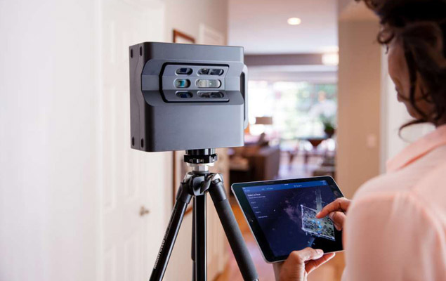
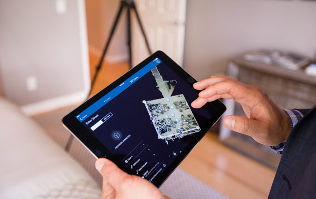
Proven to be the most accurate way to capture property conditions, 3D scanning delivers an interactive model complete with spatial dimensions and transcripts. ATI teams and technicians leverage this cutting-edge technology and the knowledge it provides to identify all affected areas of a building, develop, and deliver a rapid, yet accurate, scope of work. This expedites the insurance process, allowing us to provide remediation, restoration, and decontamination services fast, limiting secondary facility damages.
3D scanning technology is a critical tool for disaster planning and recovery. The ability to create an exact 3D model of a space allows insurance companies to proactively scan a building for an underwriting policy as well as evaluate the building post-disaster for damage. These tools give your business and our team a head start on what your building needs before a disaster strikes.
3D scanning technology projects a laser beam into a given area to digitally record the shape of an object. Through an X, Y, Z coordinate plane, we can note the exact dimensions of the object, known as a “point cloud.”
Though there isn’t a specific duration of a scan, most site scans take approximately 20 minutes. It could take longer for larger job sites, but overall, the process is extremely fast, particularly in comparison to hand-sketching and other traditional methods of architectural drawings.
3D scanning can pick up almost any hard material. The few constraints to the evolving technology include highly reflective or transparent objects, like mirrors or glass.
Once the 3D scans are complete, the created point cloud files are displayed in a visualization software application, such as a computer-aided design (CAD) software, to be analyzed.